Saguaro was our third and final stop on our Amtrak’s Southwest Chief trip following Petrified Forest and Grand Canyon South Rim. And this is the park that deepened my delight for the desert.
As a fairly proud midwestern girl, I never thought much of the American desert except sun and heat, which admittedly are not my favorite things. Our trip to Death Valley started to challenge this perception, but experiencing the nation’s largest cacti and the abundance of plants and wildlife at Saguaro National Park fully charmed my heart.
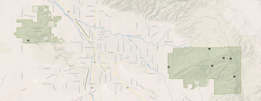
Saguaro National Park is split into two distinct districts on either side of Tucson, Arizona. Tucson Mountain District is located on the west side of town and the Rincon Mountain District lies to the east of the city. Travel time between the two districts is approximately one hour.
NPS map of Saguaro
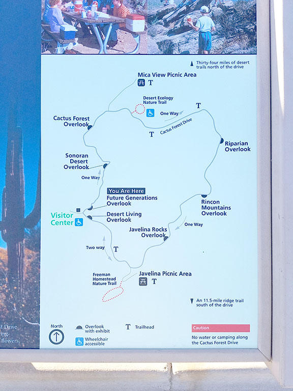
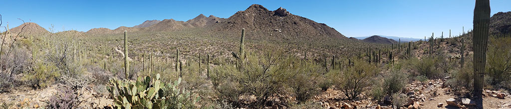
We started on the east side of Tuscon at the Rincon Mountain District with a spectacular overview via Cactus Forest Loop Drive. This scenic loop is 8 miles and features several trailheads, scenic vistas and pullouts. Trailers longer than 35 feet or any vehicle wider than 8 feet are not permitted. We saw a whole group of bicyclists finishing a ride just as we were pulling into the Visitor Center in the early morning.
Cactus Forest Loop map
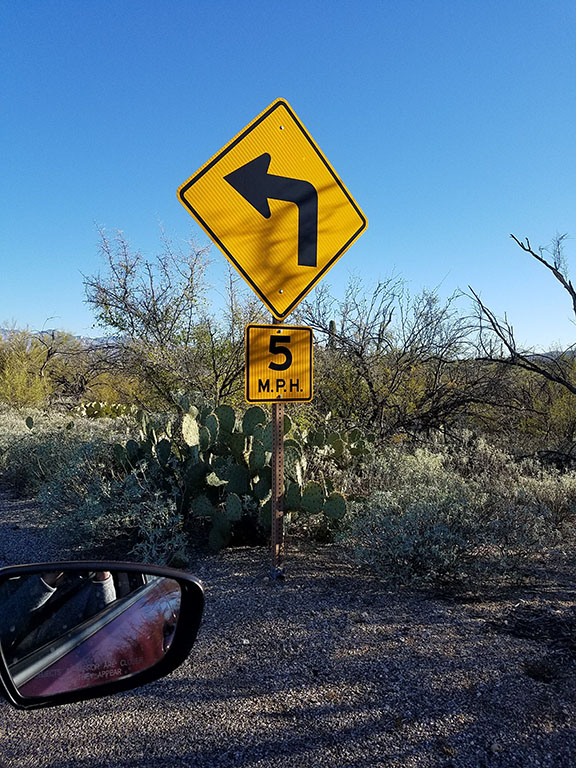
one of many 5 mph curves
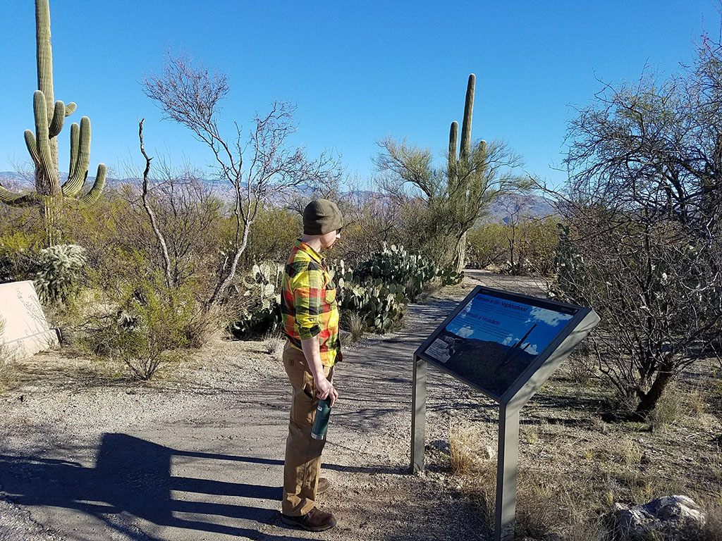
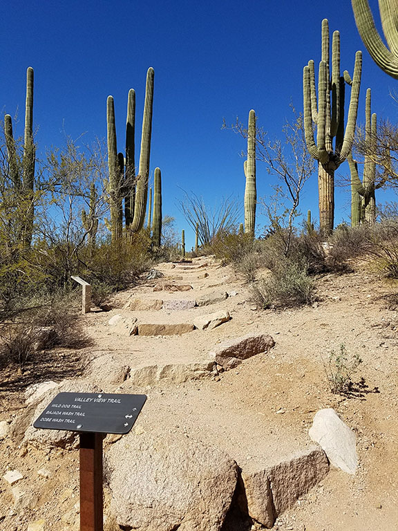
We stopped at almost every overlook and did a couple of the interpretive trails. My favorite was “Desert Ecology Trail”, an easy 1/4 mile trail that introduces you to the rugged climate of the Sonoran Desert and adaptation that allow plants and animals to thrive here.
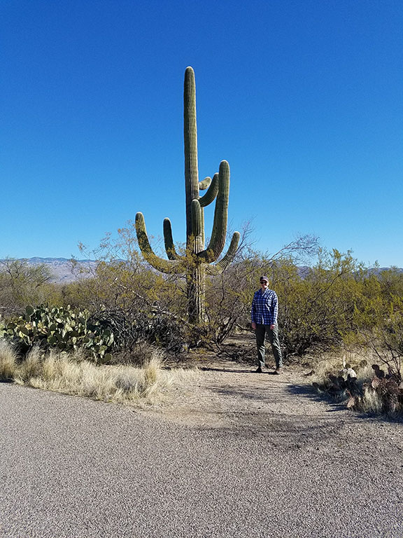
Witnessing the Saguaro namesake cactus up close was impressive. Topping out at 10′ tall and 120 years old, we imagined each with it’s own personality and story to tell.
Desert Ecology Trail
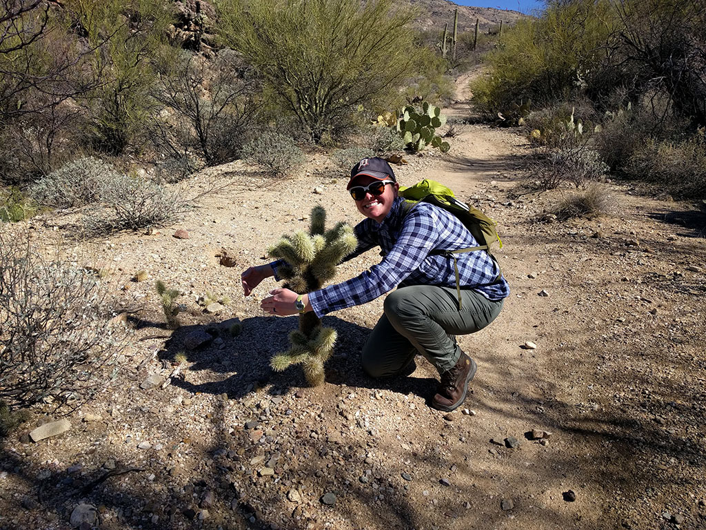
We decided we needed more than a 20 minute trail amidst these desert giants, so we went searching for “Ridge Valley Trail” beginning at the Loma Alta Trailhead. Pro tip: at the time of our visit, Google had the park boundary incorrect, but luckily we had our trusty paper maps and guidebook to navigate with. Originally, we were going to try for the 5 mile Hope Camp Trail; however, the growing heat and elevation wizened us to the 1.8 mile Ridge Valley Trail. This trail was nothing to write home about: 1 mile gravel path to the trailhead and then a moderately strenuous hike uphill to an ok view of Rincon Peak. I did, however, get to “hug” a Teddy Bear Cholla cactus, which remains a favorite pic of our trip.
Dieneke hugging a teddy bear cholla cactus
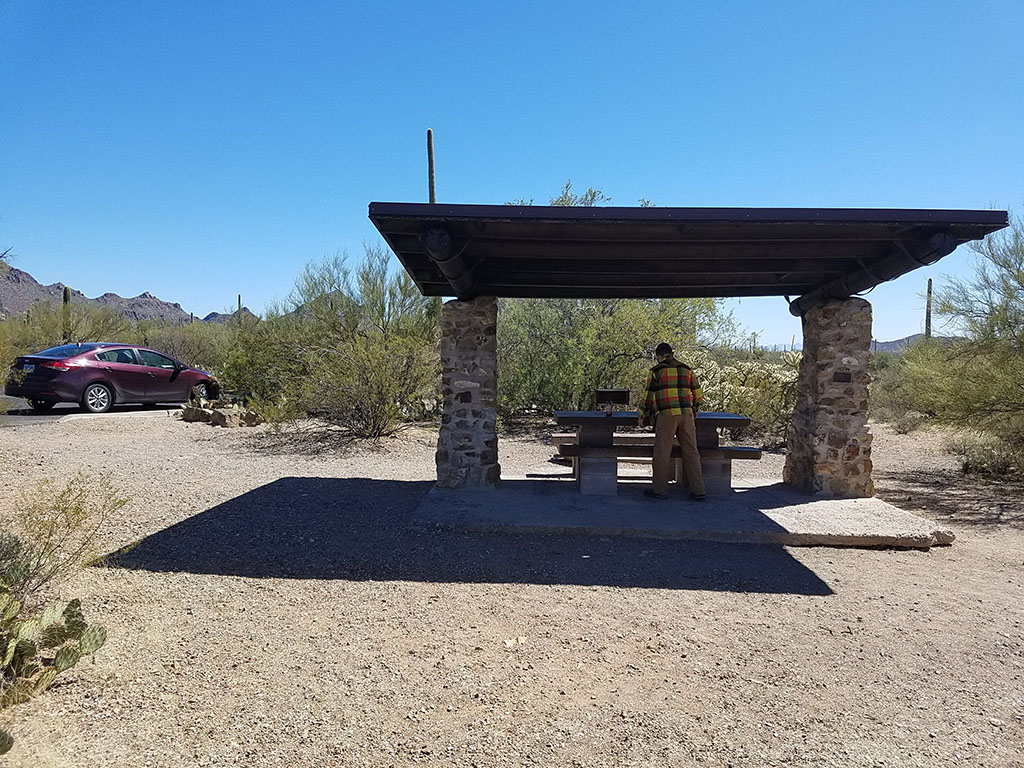
And just before noon, we were on our way across Tucson to the west Tucson Mountain District. I found a road on the map that noted “no vehicles over 25 ft long or over 10,000 lbs”, which immediately peaked our interest and turned us onto Gates Pass Road. Worth it! Had we had one more day, we would have stopped at Gates Pass Lookout or even the Arizona-Sonora Desert Museum (often paired with the TMD) but alas, we settled for a picnic lunch at Brown Mountain Picnic Area.
Brown Mountain Picnic Area
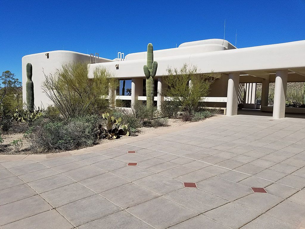
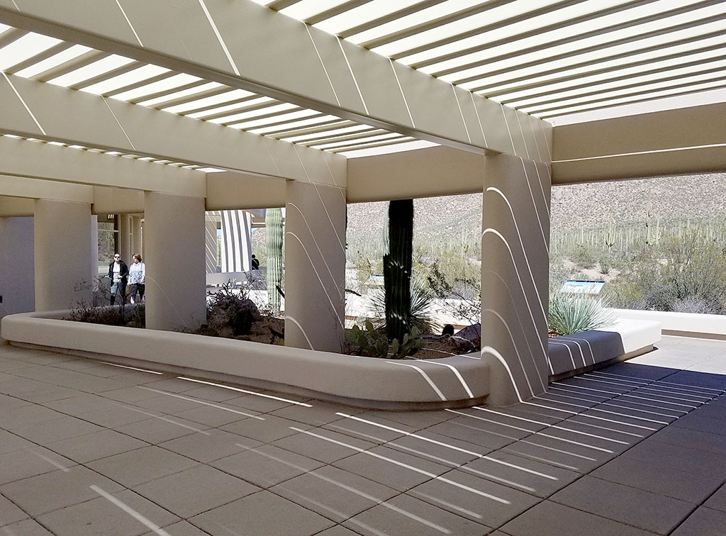
We were greeted at the Tucson Mountain District by one of my favorite visitor centers. It’s a mid-century adobe-style building with exhibits inside and out! Brandon finally pulled me away from my mini-photo shoot to take the 5 mile scenic drive Bajada Loop Scenic Drive. This similarly designed district still offers scenic pullouts and hiking trails though this road is unpaved.
Tuscon Mountain District
trail off of Bajada Loop Drive
Visitor Center
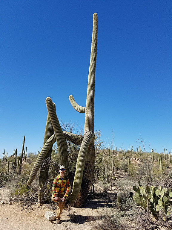
don't worry, not really sitting on the saguaro!
Saguaro truly embodies the spirit of the American Southwest: rich in extremes, adaptation and beauty. But don’t just take my word for it, check it out youself!