Death Valley

NATIONAL PARK

Death Valley National Park selfie

By DIENEKE

Death Valley National Park was the fourth stop on our One Way Road Trip.   For many years, this would rank as my #1 favorite national park (and it still remains in the top 3).   Because it was completely different then what I imagined!  I expected hot, of course, and generally a barren landscape of sand and rock.  But what ended up being our experience was extreme contrast, variety and color!  

And that’s what Death Valley is all about: the extremes: the lowest point and hottest temperatures.  But you will still find vistas and life!  It’s a place that will make you feel like you’re on another planet and this transportation can give even your wildest imaginations a trip to remember. 

This Park is one that requires some planning.  While we were flying fairly spontaneously on this trip, we did not mess around before entering this Park.  We made sure we were gassed up, did a check on tires & oil, and had plenty of water & food.  While there are plenty of dangers in all Parks, the desert isn’t something we know very well, so we did our research and were prepared with the aforementioned items.

Average Monthly Temperatures per NPS

We arrived the evening before and set up camp in eclectic Panamint Springs Resort.  I felt like we just hoped off of Route 66 into a ghost town.  It was spectacular.

Death Valley National Park_Panamint Springs Resort
Panamint Springs "Resort"

We woke very early to beat the heat and headed into the Park.  We would only have 1 day here, so the Burro came in tow (and my favorite pictures of the Burro are in this park).  Our first stop was Mesquite Flat Sand Dunes, which is how I had pictured Death Valley in my head; however, this proved to be an infintesimally small part of the Park.  We also came across the first of many signs warning of the extreme heat.

Death Valley National Park_Mesquite Flat Sand Dunes
Mesquite Flat Sand Dune
Death Valley National Park_heat kills sign
The many warning signs of Death Valley
Death Valley National Park_extreme heat sign
We passed up Scotty’s Castle and much of the Furnace Creek area and continued south to Badwater Basin: the lowest elevation in North America (282′ below sea level).  The Salt Flats in Badwater Basin cover nearly 200 square miles, among the largest protected salt flats in the world, and although the flats are too harsh for any plant or animal to survive, they are very fragile.  Somehow, we are experiencing these epic “must-sees” virtually all by ourselves, which make this landscape seem all the more extreme.  
Death Valley National Park_Salt Flats at Badwater Basin
Salt Flats & Badwater Basin
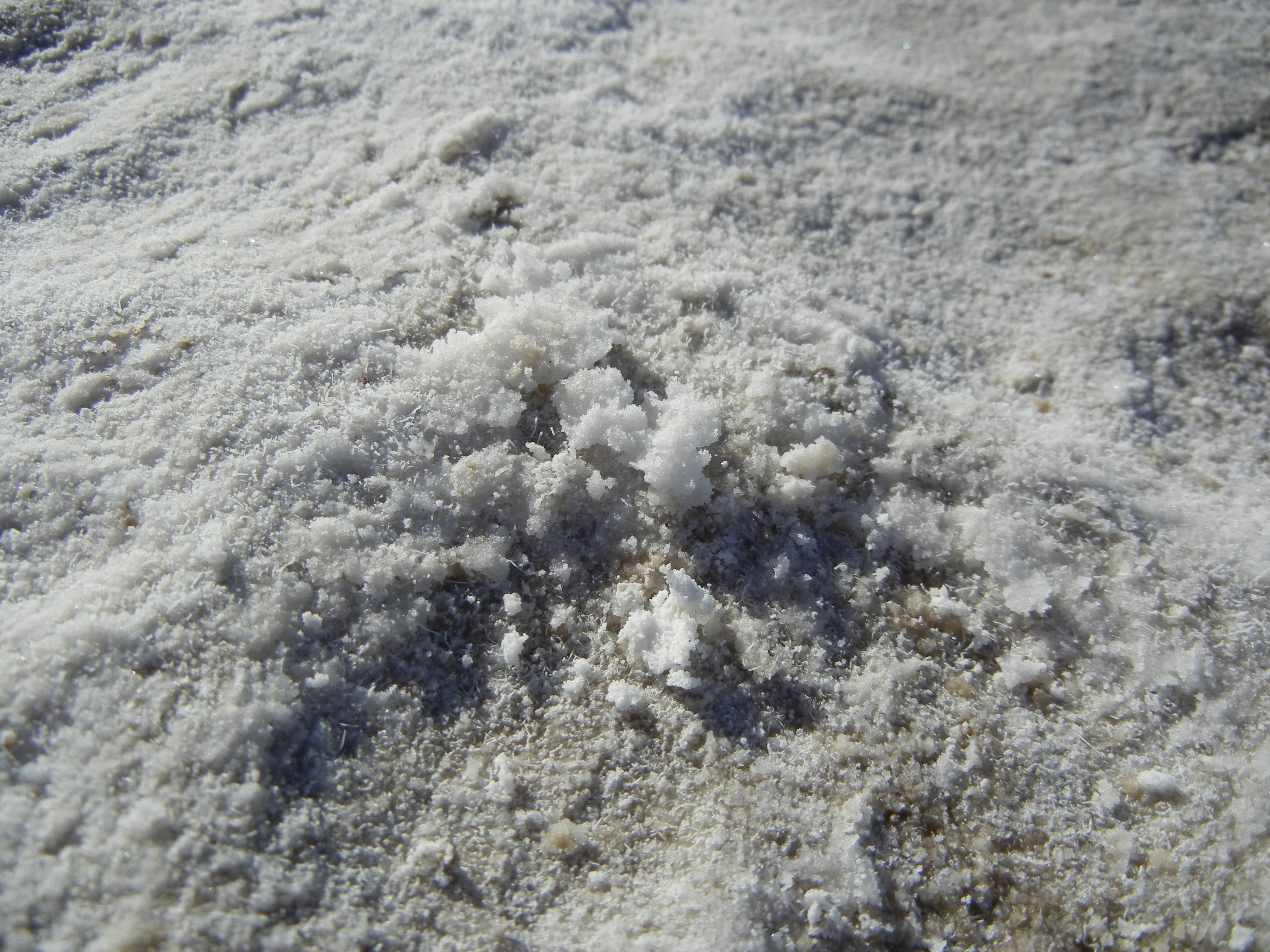
Devil’s Golf Course was up next (you know how I love the nomenclature of the National Parks; well, it doesn’t get any better than Death Valley).  It’s down a short dirt road but is worth the drive as many people skip this on their way to Badwater.  If the salt flats are fragile, the golf course is hard as nails.  Many reader boards warn that a fall could result in cuts or even broken bones.  It also suggests to “listen carefully.  On a warm day, you may hear a metallic cracking sounds as the salt pinnacles expand and contract.”  This is what makes the trip worth going as pictures might “speak” a thousand words, but there are 4 other senses to discover. I never thought we’d see so much color in Death Valley as in Artist’s Drive!  This 9 mile, one-way scenic loop through colorful canyons caused by the oxidation of different metals (red/pink/yellow = iron; green = mica; purple = manganese).  It looked like a giant had dropped a container of watercolor brushes.
Death Valley National Park_Artist Drive
Artist's Drive

We only did one hike and that was intentional.  As a native Michigander, I am definitively “heat-intolerant” and this was about as much as I could muster.  We took the moderate 2.7 mile loop at Golden Canyon.  We hiked through the colorful canyons carved through the golden badlands.

Death Valley National Park_Golden Canyon hike
Golden Canyon hike
We momentarily lost our solitude at Zabriskie Point.  However, this is not to be missed.  Insider tip: the buses come in waves and since there’s not too much to do at this pull-out, eventually the groups will take off and you will get a few moments to yourself.  Just wait them out!  There is a 1/4 mile jaunt up 60′ but the path is paved from the parking lot.
Death Valley National Park_Zabriskie Point
From Zabriskie Point
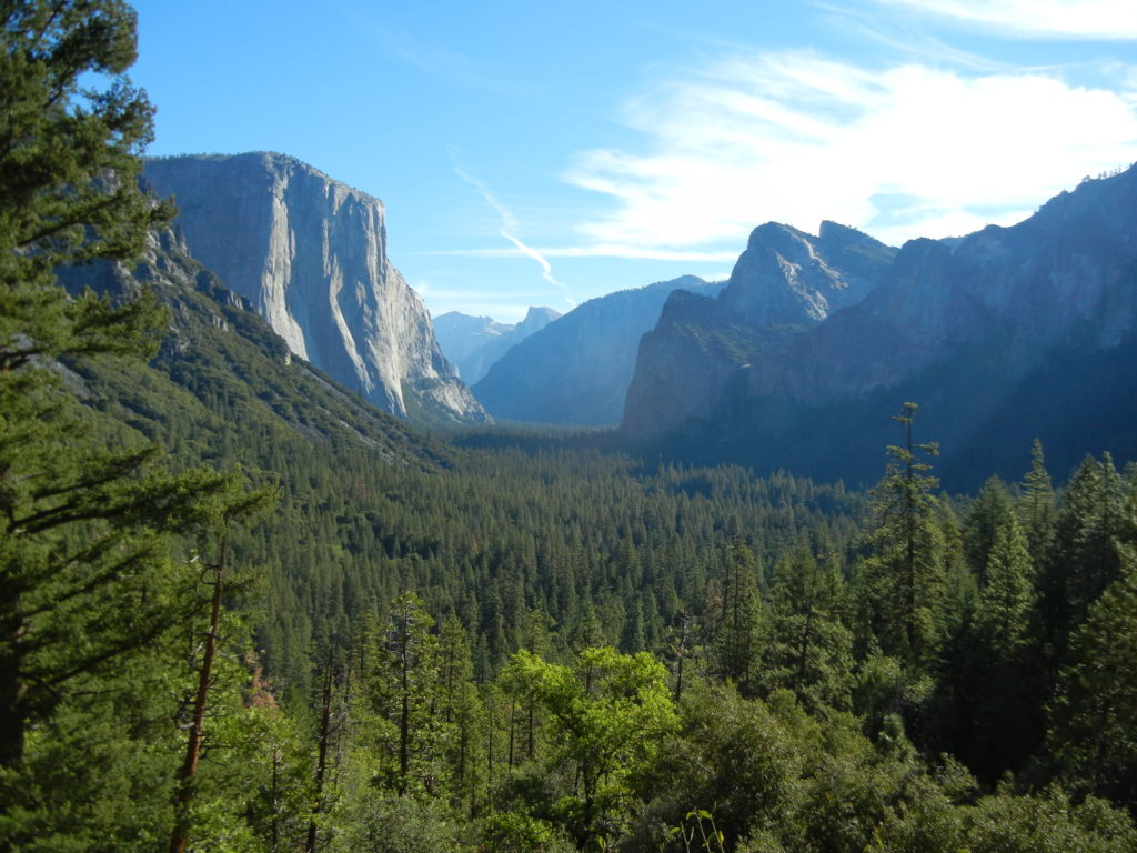
We escaped the crowds for our final stop of this magical valley: Dantes View.  In my opinion, this was even better than Zabriskie, and with a 25′ vehicle limit, we knew there would be no buses or giant RV’s (we did drop the trailer in the trailer parking lot just to be safe – and were glad we did with the steep grade!).  It’s 13 miles from the main road but gave us view to talk about for hours/years to come.
Death Valley National Park_Dantes View
From Dantes View
Death Valley: a lesson in expectations and extremes.