Arches

NATIONAL PARK

Arches National Park selfie

By DIENEKE

Arches National Park was the eighth stop on our One Way Road Trip. Arches and Canyonlands are another good pair to see together due to their close proximity.

This park has over 2,000 natural stone arches (as the name would imply) but also soaring pinnacles, enormous wall fins and gravity-defying balanced rocks.  Due to the impressive formations, achievable size of the park and great accessibility of many trails, this is a very popular park.  We visited in mid-October and arrived as the sun was rising; we had no issues with crowds.  However, this is an atypical experience, so much so that the National Park now has traffic charts and webcams to aid visitors in planning their adventure.  This can all be avoided by traveling during the shoulder seasons and getting up early or traveling later in the day (the photos are much better anyways)!

Arches National Park Map
NPS map of Arches
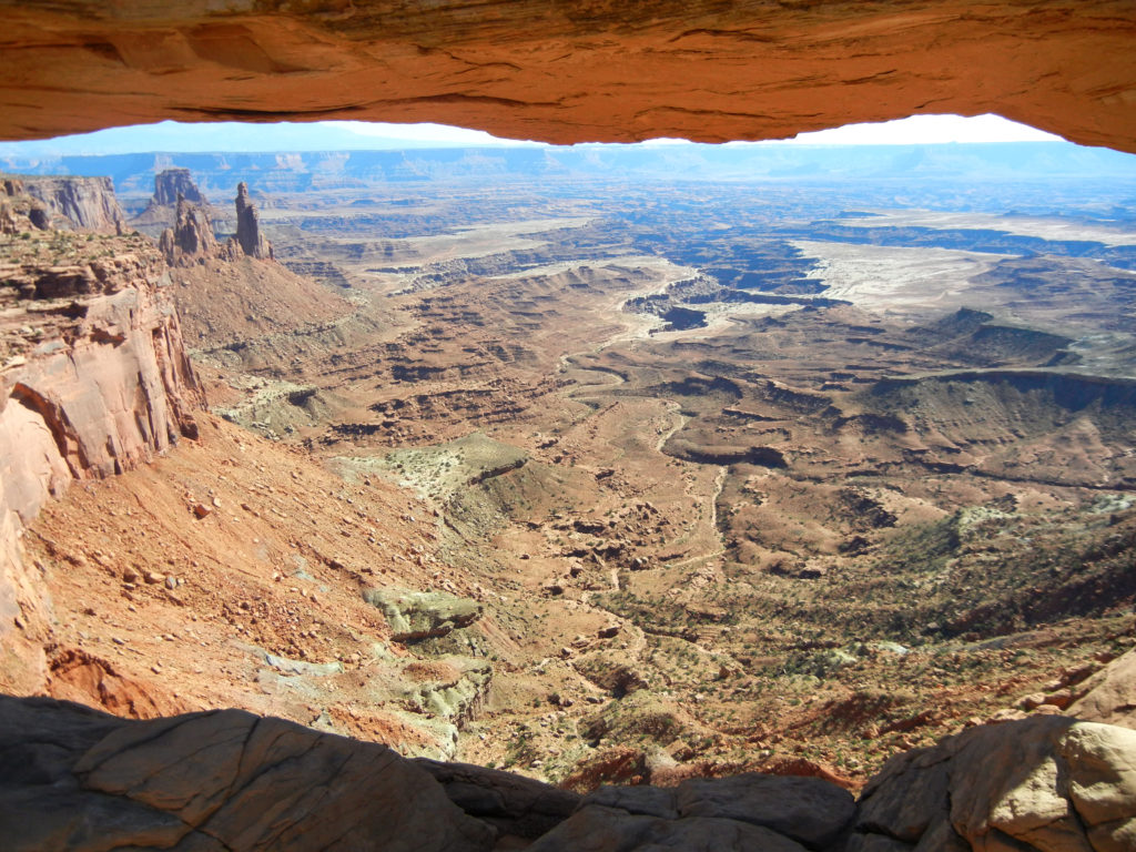
Shortly after entering the park, we were greeted by the massive walls of Park Avenue.  As the sun was just beginning to rise, the shadows receeding down the rock made us feel like we were waking up with the earth.
Arches National Park_Three Gossips
Three Gossips

The drive through the Petrified Dunes expands your views allowing you to see ahead to one of the most famous formation: Balanced Rock.  We hopped out immediately onto the trail to get a closer look.  The Balanced Rock trail was a short loop, mostly paved trail that allowed us to stretch our legs and warm us up for what turned out to be almost a gallery-like visit around awe-inspiring pieces of art.

Traveling east took us to the Windows Section and more iconic sandstone sculptures.  The Windows trail was an easy 1 miles gravel trail leading right to the bases of the massive North and South windows and Turret arch.

Arches National Park_Balanced Rock
Balanced Rock
Arches National Park_North and South Windows
North & South Windows
Returning from the spur of Windows, we turn the next right to the Delicate Arch viewpoints.  We didn’t have time for the 3 mile round-trip hike to Delicate Arch so had to settle for the long-range view which was still exquisite.  There’s also a 4×4 trail down Cache Valley Road that called to Brandon’s off-road desires (the “Impassable when wet” sign only added to the appeal).
Arches National Park_Delicate Arch
Delicate Arch
Arches National Park_Cache Valley Road
Cache Valley Road
Getting back on the main road will take you to the end at Devils Garden Campground (the only one in the park).  There’s even more trails ranging from 15 minutes to 5 hours.  On our return to the entrance, we stopped at Fiery Furnace which is a maze of narrow standstone canyons that for us in the Midwest would equate to a cornmaze for adults.  You can actually explore this labyrinth on a ranger-guided hike or by obtaining a day-use permit at the visitor center.  What better way to get into the middle of the raw material of art!
Arches National Park_Fiery Furnace
Fiery Furnace
Driving through the Courthouse Towers area in reverse revealed more hidden pinnacles and fins waving good-bye just as the line was forming at the main entrance.  There’s nothing quite like the feeling of having experienced a park almost all by yourself, on your own terms, able to appreciate it as you desire.